San Vicente Redwoods: A History of Industry, a Future of Conservation
Survivors for millennia, the magnificent redwoods of the San Vicente drainage have stood strong despite man-made and natural challenges over the past 150 years. Now, an inspired collaboration of private, non-profit partners has undertaken a comprehensive restoration and conservation plan for the forest, gulches, and rolling hills that extend from the Empire Grade ridgeline down to the Pacific Coast.
At six miles long and 2.5 miles wide, the land now known as San Vicente Redwoods is the largest privately held property between Silicon Valley and the Pacific Ocean. Four organizations, collectively called the “conservation partners”, acquired 8,532 acres for $30 million in December 2011 (with significant grant funding). A separate adjacent 320-acre parcel was added in 2019.
Public access and recreation have been part of the plan for the larger parcel since its acquisition. An access plan—all 134 pages—was drafted by the Land Trust of Santa Cruz County (LTSCC) after five years of study and community engagement. The plan lays out a multi-use trail system with ground rules to protect the forest’s unique habitats, watersheds, and resources while allowing for hikers, bikers, and equestrians to experience this incredible place.
The four partners will open the first phase of trails on December 3, 2022. After twelve years of intense planning, they're hoping they’ve struck the right balance between visitor enjoyment and the project’s forest restoration, stewardship, and research goals. Future phases of the trail system and continued public access is dependent on how visitors treat the land going forward.
Gorgeous Forest
"It’s a gorgeous forest with a lot of history,” said Irina Kogan, director of landscape conservation with Peninsula Open Space Trust (POST), which co-owns the property along with Sempervirens Fund. “The goal is to create a resilient, balanced redwood landscape where trees, wildlife, and people can thrive.”
POST, Sempervirens, and LTSCC were joined by Save the Redwoods League, which paid $10 million for a conservation easement that will protect the land in perpetuity—including public access. LTSCC holds a special role overseeing planning and managing access.
“LTSCC is excited to open phase one of our 38-mile trail project. This is a critical trial—future phases of trail building are dependent on responsible public access—or the successful use of the first 8.5 miles of trails,” says Sarah Newkirk, the LTSCC executive director. “As long as trail users are respectful and there are no unacceptable impacts to the biological resources, we’ll be able to continue building out this multi-use trail system.”

Trail building experts at Santa Cruz Mountains Trail Stewardship (SCMTS) have played a key role in bringing these trails to fruition. LTSCC contracted with SCMTS to construct the trails that hikers, bikers, and equestrians will all enjoy for years to come.
“We’re honored to support the work of the conservation partners and work with the Land Trust on trail development and creation throughout the San Vicente Redwoods property,” said Matt De Young, executive director of Santa Cruz Mountains Trail Stewardship. “This is a unique project due to the high level of collaboration between land management and conservation groups. We’re grateful to play a meaningful role as this land is opened up for public access.”
38 Miles of Potential Trails
The plan calls for 38 miles of trails to eventually be built in three phases, affecting just 2 percent of the property with each phase. Construction of the first eight miles is nearly complete and will have a dual purpose — they’ll provide new recreation opportunities and also function as a fuel break. Multiple wildfires have transformed the property over the years: a 15,892-acre wildfire swept through the region in the late 1940s. In 2009, the 7,800-acre Lockheed Fire burned across 1,600 acres of the property, and most recently, the 2020 CZU Lightning Complex Fire burned 86,509 acres, including about 98% of San Vicente Redwoods. All the Phase 1 trails fall within this recovering landscape with burned tree canopies and colonizing scrubby vegetation bordering the trail edge.

Each subsequent phase will proceed as long as visitors honor and respect the rules and responsibilities of enjoying the trails. Land and wildlife conservation is always paramount, the land managers say. Even if all 38 miles of planned trails are eventually completed, 94 percent of the property will be reserved for restoration, wildlife protection, and selective timber harvesting, with no public access. “The trail system is well-designed in that it doesn’t go all over the property,” said Nadia Hamey, the forester who serves as property manager.
“San Vicente Redwoods is the poster child for the Conservation Blueprint for Santa Cruz County,” said Bryan Largay, conservation director for LTSCC, who led the creation of the plan. “Our public access plan connects people to nature, a key element of a healthy community.”
A Most Collaborative Project
“This is the most collaborative project and plan. Four organizations coming together, and each one of us is making a part of the project happen,” said Laura McLendon, director of land conservation at the Sempervirens Fund. “The plan was reviewed by countless experts, so many top minds,” she said. “There had to have been around 35 peer reviewers when usually there are none.”
LTSCC’s Newkirk said the four groups met weekly for seven years. “We talked with more than 300 people in small meetings, had 400 people attend two public meetings, and received 2,300 responses to an online survey.”
Land’s Legacy
The land includes redwoods—both second growth and some old growth—oak woodland, chaparral, coastal terraces, and fern gulches extending from 2,600 feet elevation at Bonny Doon and Empire Grade down to near Davenport on the Santa Cruz County north coast. The hope is to eventually link San Vicente with the Cotoni-Coast Dairies Unit of the California Coastal National Monument, just along Highway 1.
The Awaswas-speaking Ohlone peoples thrived on this land for thousands of years as hunter-gatherers who lived in large settlements near sources of fresh water. In the late 1800s, a large portion became part of the San Vicente (Escamilla) land grant. Today, the conservation partners are working with the Amah Mutsun Land Trust to research and survey cultural history at San Vicente Redwoods and to reclaim connections to ancestral lands and traditions.
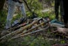
Clear-cutting redwoods by the San Vicente Lumber Co. began in the early 20th century and stripped the mountainside. Only 90 old growth trees remain. Today, more than 80 miles of logging roads and trails still crisscross the land. Some will be maintained, others restored back to nature.

At one time, a rail line connected the property to bring redwood logs down to the coast, and dams were installed along Mill Creek to support logging and mining operations. In 1923, shortly after buying the rail line, the logging company went out of business. The land was returned to the Santa Cruz Portland Cement Co., the previous owner. Portland Cement Co. built another railroad following San Vicente Creek to link its limestone quarry with the cement plant in Davenport.
Over the years, the cement company was bought and sold several times until it became part of Cemex, the Cement Company of Mexico. By 2010, the future of the Cemex-owned land was uncertain. Development and unsustainable logging were likely prospects as the company looked to squeeze profits from its holdings.
Restoration Has Begun
While restoration activities planned throughout SVR are far from complete, a lot of work has already been accomplished in the 10-plus years since the conservation partners began their ownership. The partners recently worked with the Bonny Doon Fire Safe Council to complete a 100-acre forest thinning project and are underway doing 360 more acres. Also, 11 miles of shaded fuel break have been created along roads and ridgelines. Nine more miles are planned.

“We’re doing a lot of work on restoration throughout. We want wildlife to have reproductive success and freedom of movement,” said Hamey, who has worked on the property since Cemex owned it and as a forester for Big Creek Lumber for a decade before that. She knows the land better than anyone.
Using wildlife tracking cameras and a multi-year study, Chris Wilmers, of the Santa Cruz Puma Project at UC Santa Cruz, has also been instrumental in advising how and where to avoid mountain lion den sites.
Earlier this year, POST planted 23,000 redwood trees and 900 Douglas fir seedlings in high burn areas to create a more diverse and healthier age class distribution within the forest. A timber harvest plan is also underway that will cover the next few years of work of thinning tightly crowded second-growth trees and creating shaded fuel breaks to slow the spread of wildfire enough for emergency services to access the property safely. This work is vital to restoring the forest and allowing larger trees to thrive—edging them closer to old growth conditions and making them more resilient to drought.
Other restoration work includes improving water crossings along Scott Creek, placing wood in half a mile of stream along San Vicente Creek, and removing a dam along Mill Creek to encourage coho salmon spawning throughout the property.
Fire’s Conservation Role
In February of 2020, when weather conditions were perfect, a 25-acre strip along Empire Grade was part of a prescribed burn. POST also hired the Native Stewardship Corps of the Amah Mutsun Land Trust, descendents of the original inhabitants before European, Mexican, and American colonization, to remove excess fuels and lessen the risk of wildfire in a portion of the property designated as a Restoration Reserve. The 2020 CZU fire crossed the landscape just six months later, and the recently burned fuels on the forest floor surely played a role in helping the oak woodlands along Empire Grade near the new parking lot survive the wildfire. Six years ago, before a five-acre controlled burn, the Amah Mutsun Tribal Band helped oversee the first ceremonial fire on the land in more than 200 years.

Trail Building Nears Completion
“We’re excited that construction is finally starting and that we are looking to open this fall with a really successful project overall,” McLendon said.
The entrance will include a 75-space parking lot off Empire Grade Road. Visitors will be required to register for a free trail pass through LTSCC’s website before entering. Community members are invited to pre-register for their free SVR trail pass in person at their Community Preview Event on September 24th at the Old Wrigley Building Parking Lot, and additional pre-registration will be available online beginning October 2nd. Passes will be mailed out prior to the SVR Grand Opening on November 12-13th. Passes, parking, and access are free. San Vicente Redwoods pass holders will be notified of property closures, heavy storms, red flag days, conservation harvest events, and private community events.
Trails will be open for a range of user groups, with different trail segments for hikers, mountain bikers, and equestrians. The partners emphasized that further trail construction depends on how visitors treat the land. “It’s a forest out of balance and still in need of healing,” said POST’s Kogan.
“The goal of the entire project was to provide a rare recreational experience while protecting the natural resources of the property,” said Sarah Newkirk of the Land Trust. “We think we found the sweet spot.”
By Guy Lasnier